Documents
Lot 1979 SESSION 8 (2.30PM TUESDAY 31ST AUGUST) Documents
Estimate $500
Bid at live.noble.com.au
SOLD $600
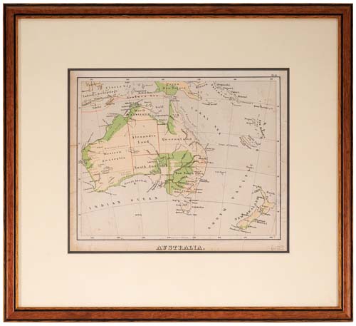
AUSTRALIA MAP, in colour (approx 28.5x24cm), c1880, showing Alexandra Land and North Australia (these now both Northern Territory), and also Hobart Town (renamed Hobart in 1881) in Tasmania, map with raised surface for mountainous areas, double matted and framed under glass (approx 45x40.5cm). A few foxing spots on map and a few edge tears, otherwise fine.
Estimate / sale price does not include buyer's premium (currently 22% including GST) which is added to hammer price. All bids are executed on the understanding that the Terms & Conditions of sale have been read and accepted. For information on grading and estimates please refer to the Buying at Auction advice.
Quick find
View a lot by number and sale.
Adjacent lots
Lot 1977
NEW SOUTH WALES MAP, (approx 34x26cm), published Jan 4 1828 by Samuel Arrowsmith, No. 10 ...
Estimate $500
Lot 1978
NEW ZEALAND MAP, Carte de la Nouvelle-Zelande pour servir au Voyage pictoresque autour du Monde ...
Estimate $300
Lot 1979 This lot
AUSTRALIA MAP, in colour (approx 28.5x24cm), c1880, showing Alexandra Land and North Australia (these now ...
Estimate $500
Lot 1980
TONGA, Plan of Tongatapu scale map (approx size 70x50cm), a vintage map on dark pink ...
Estimate $50
Lot 1981
COLOURED PRINT OF A MAN CARRYING A LARGE NUGGET OF GOLD FROM PORT PHILLIP, (approx ...
Estimate $100